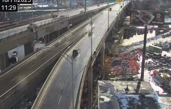
Dawson Creek › Osten: Highway 97 at Dangerous Goods Route, west of - looking east
![]() Dawson Creek, Kanada
Dawson Creek, Kanada
Real-Time Environment
Welcome to the live streaming webcam for Dawson Creek › Osten: Highway 97 at Dangerous Goods Route, west of - looking east, perfectly situated in the vibrant region of Dawson Creek, Kanada. Watching this live camera allows you to instantly experience the local atmosphere and monitor current climate conditions.

About Dawson Creek
Dawson Creek ist eine Kleinstadt im Nordosten von British Columbia in Kanada mit 12.178 Einwohnern. 2011 betrug die Einwohnerzahl noch 11.583. Die Stadt hat den Beinamen „Mile 0 City“, da sie den südlichen Abschluss bzw. Anfang des Alaska Highway bildet. Die zugehörige Wegmarke Mile 0 Post ist Hauptelement der Stadtflagge. Der Name Dawson Creek stammt vom Bach desselben Namens, der durch die Stadt fließt und von einem Landvermesser im August 1879 nach George Mercer Dawson benannt wurde. Da die Stadt Dienstleistungszentrum des ländlichen Umlandes südlich des Peace River, Sitz des Peace River Regional District und Verkehrsknotenpunkt auf dem Weg von Alberta in den Teil British Columbias nördlich der Rocky Mountains ist, gab sie sich den Titel The Capital of the Peace.
📖 Read more on Wikipedia📍 Location Facts
-
Country
 Kanada
- Region Britisch-Kolumbien
- City Dawson Creek
- Coordinates 55.7666°N, -120.2765°E
Have you been to Dawson Creek?
Help the community! Share your experience, tell us about the weather, or upload your own photos from this exact location.